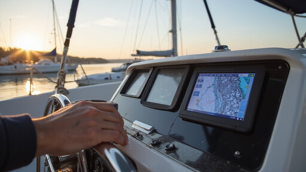
Ever wonder how boaters stay safe and navigate accurately on the water? A chartplotter is the all-in-one device that combines GPS with electronic nautical charts to show your real-time position, heading, and speed.
It can also alert you to hazards, help you plot routes, and connect with other systems like sonar or radar.
Keep reading to find out how this essential tool can improve your boating experience.
What Is a Marine Chartplotter and How Does It Work?
A marine chartplotter is an electronic navigation device that uses GPS data combined with digital nautical charts to display your vessel’s position in real time. It shows your current location, heading, and speed directly on an electronic map, updating automatically as you move. The system aligns GPS signals with a stored chart, overlaying your boat’s icon for quick and clear situational awareness.
High nautical chart accuracy is essential for precise navigation, helping you avoid hazards like rocks, wrecks, or shallow areas. Pairing the chartplotter with sonar technology provides underwater mapping, revealing seabed features and bottom contours that are otherwise hidden from view. You can mark waypoints, create and follow routes, and calculate bearings or estimated times of arrival, making route planning straightforward and reliable. For the best fish-finding results, many models include integrated fish finder capabilities to combine navigation with underwater scanning. For boaters seeking optimal fish-finding capability, reviewing the top depth finders helps compare integrated performance options.
Additionally, a chartplotter often integrates with other sensors such as radar, AIS, and wind instruments. This makes it a comprehensive navigation hub, centralizing vital data and improving safety and efficiency on the water.
Why Every Boater Needs a Chartplotter for Safer Trips
Continuous position awareness is essential for safe boating. Your chartplotter provides real-time location updates, showing exactly where you are on the chart and alerting you to dangers such as rocks, shallow areas, or submerged obstructions. You can zoom in to improve visibility, allowing you to see course, distance, and hazards instantly. Preplanned routes are helpful—these can flag shallow sections before you depart by considering your boat’s draft and tide changes, so you can plan accordingly. For catfish anglers, selecting a model with high-resolution sonar can help identify underwater structure where catfish often hide. When comparing fish finder options, many boaters look for a model with top-tier performance to ensure reliable readings in various conditions. If your boat has an autopilot, integrating the chartplotter can automate your course along a route for a truly hands-free sailing experience. Remember, your electronic tools should support your lookout, not replace it. Always cross-check the data from your chartplotter with your compass and depth sounder to verify your position. Treat the chartplotter as just one layer of your overall safety system, and maintain backup discipline to ensure you stay safe on the water.

MULTIFUNCTION DISPLAY: With GO9, add GPS navigation, sonar support, radar capability, and much more to your boat: perfect for sportboats, center-consoles, and smaller cruisers

MULTIFUNCTION DISPLAY: With GO9 XSE, add GPS navigation, sonar support, radar capability, and system integration to your boat—ideal for sportboats, center consoles, and coastal cruisers

Dual Beam Sonar: Choose from a narrow and a wide beam for great detail or a generous coverage area, helping you identify fish, structure and contours.
GPS, Sonar, and Networking: The Essential Chartplotter Features
GPS, sonar, and networking form the essential core of a modern chartplotter. Your device’s GNSS receiver integrates signals from multiple satellite systems like GPS, GLONASS, Galileo, and BeiDou, ensuring strong coverage regardless of your location. A 10 Hz refresh rate means your position updates ten times every second, providing smoother tracking and more accurate course adjustments. For sonar, built-in CHIRP technology enhances your underwater imaging by improving target separation and bottom detail clarity. Scanning options such as SideVü offer nearly photographic views of what’s beside your vessel. On the networking side, protocols like NMEA 2000 and Ethernet connect your chartplotter to other marine electronics, allowing data sharing for waypoints, routes, sonar, and radar. These connections enable you to synchronize your autopilot and engine displays with your navigation system. Wireless options like Wi‑Fi and Bluetooth add convenience, enabling remote control, chart updates, and smartphone mirroring without wires cluttering your cockpit. For a clean installation, follow proper wiring guidelines to ensure reliable power and data connections.

Dual Spectrum CHIRP Sonar: Delivers views of fish arches and fish-holding structure with two ways to search — Wide Mode for maximum coverage and Narrow Mode for detailed scanning; Precise 2D target separation powered by Low-Q transducer

Premium Sonar Technology: MEGA Side Imaging+ with 200-foot range on each side; MEGA Down Imaging+ reaches 200-foot depths; Dual Spectrum CHIRP with wide and narrow modes for detailed fish detection

The bright 5” keyed display is made for convenience.
Key Chartplotter Uses: Fishing, Cruising, and Commercial Navigation
Your chartplotter’s true value comes from how it customizes navigation for your specific mission. For fishing, you’ll mark fish-holding structures like reefs and drop-offs, then use waypoints and tracks to return precisely. Drift alarms help keep you on target, while AIS overlays reveal nearby working boats and productive zones. When cruising, you plan safe passages by plotting routes around hazards and relying on accurate marine charts to navigate unfamiliar harbors. Commercial operators depend on ENC-capable displays for route monitoring and hazard avoidance, often integrating radar and AIS for a comprehensive traffic picture. For the best results, you should choose models known for high performance that also balance quality and value. Whichever type of navigation you focus on, a user interface designed for quick access ensures you can easily view critical data—such as depth contours or vessel positions—without distraction. This enhances your situational awareness and safety on the water. For a complete setup, be sure to pair your chartplotter with top boat gauges that provide reliable engine and fuel data at a glance. Clear VHF reception also depends on a well-matched marine radio antenna to ensure your position reports and safety calls reach the coast guard or nearby vessels without static.


FITS YOUR GARMIN BAIL MOUNT: A direct replacement for the knobs on EchoMap UHD and UHD2 chartplotters in the 7Xsv and 9sv series, GPSMAP f/7xx and f/7x3, and VHF 110, 115, 210, 210 AIS, 215 and 215 AIS marine radios. Ships as a 2-pack, two knobs per order.
Standalone, Combo, or Multifunction: Which Chartplotter Type Fits You Best?
The best chartplotter type for you depends on your boating needs and how you prefer to operate. If simplicity and affordability are your priorities and you run small or weekends boats, a standalone chartplotter is ideal. It offers straightforward navigation without extra features, helping keep your helm uncluttered. While it lacks built-in sonar, it delivers reliable GPS and charting functions that cover the basics. For those who also want to track speed, a review of the top speedometer picks can help you choose a compatible unit. For anglers seeking cutting-edge fish targeting, live sonar can be added to some standalone units, though it often works best with a dedicated display. For anglers who want integrated sonar and navigation on a single screen, a combo chartplotter/fishfinder makes sense. It combines charts and sonar data in a compact, easy-to-use display. This setup simplifies your cockpit with one device instead of multiple units and provides clear bottom readings, which are essential for fishing. Many modern combo units, like a Garmin Echomap UHD2 93SV, offer high-resolution sonar for detailed underwater views.
If you need a central control hub for various electronic systems, a multifunction display (MFD) is the best choice. It connects radar, AIS, autopilot, and other digital systems, streamlining your helm. While many MFDs include fishfinding features, their primary advantage is managing a fully networked boat efficiently, reducing clutter and allowing for complex data analysis. Choose based on how much integration you require for your boating style.

Garmin ECHOMAP 53cv UHD2 is a chartplotter that comes with 5” color display

Professional Marine GPS Chartplotter at an Unbeatable Value: This pre-configured tablet offers a high-performance Boat GPS Navigation system at a fraction of the cost of traditional hardware. At just $299 USD, it delivers the power of a Multifunction Display (MFD) without the premium price tag.

Easy-to-use 7” color fishfinder with new vivid scanning sonar color palettes to easily distinguish fish and structure; tilt/swivel bailmount bracket included
How to Choose the Right Chartplotter for Your Boat
Ensure your chartplotter supports NMEA 2000 and Ethernet connections. These interfaces enable seamless data sharing with radar, sonar, and autopilot systems, enhancing your boat’s integrated navigation setup. Wireless connectivity simplifies software updates and system control without cluttering your helm with cables. When choosing sonar, match the unit to your fishing or cruising style; CHIRP sonar offers versatile, high-quality imaging suitable for most activities, whereas advanced imaging options are primarily beneficial for serious anglers seeking detailed views of underwater structures. Verify the device has at least IPX7 waterproofing to withstand splashes and rain, and confirm it matches your boat’s power requirements to prevent electrical issues. A smart purchase balances your budget with essential features and provides room for future upgrades, ensuring your chartplotter remains compatible as your needs evolve.

Clear Vu scanning Sonar shows you more of what is in the water around your boat; This high frequency sonar gives near photographic images with detailed representations of objects, structure and fish

Bright, sunlight-readable 9” touchscreen with keyed assist

MEGA Side & Down Imaging Technology: View fish, structures, and contours 125 feet on either side of your boat and 125 feet directly beneath your watercraft with 3x more detail than standard imaging sonar; Transducer included